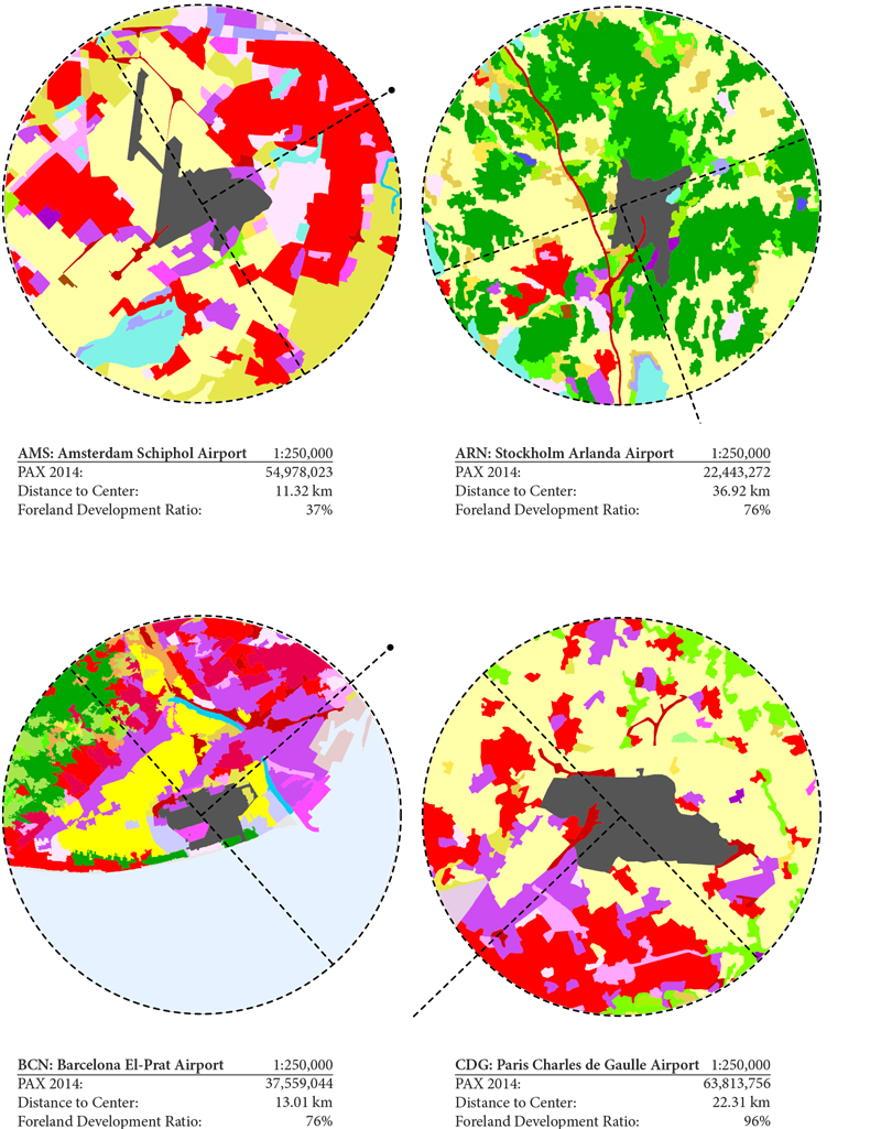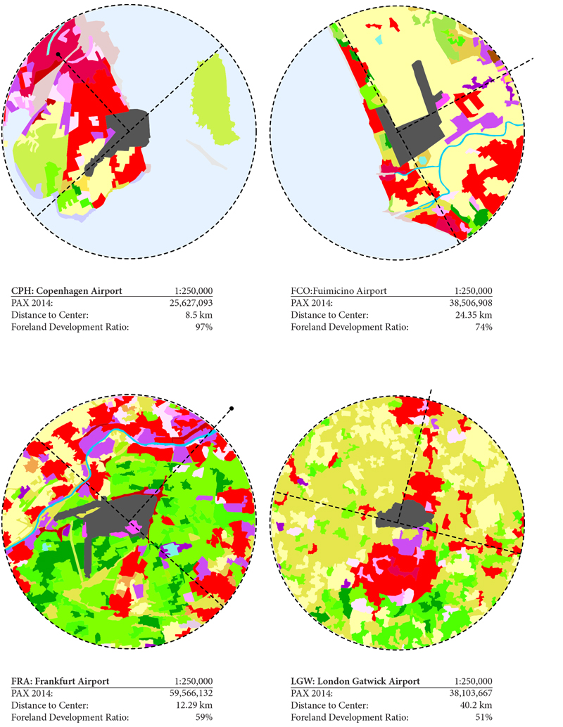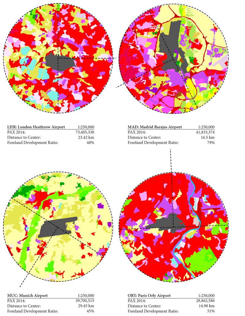
A few years ago, working on a research proposal for the Swiss National Science Foundation, I began a series of studies on European airports. I wrote a few scripts to query different European GIS databases and extract and analyze information on the urban areas near airports.
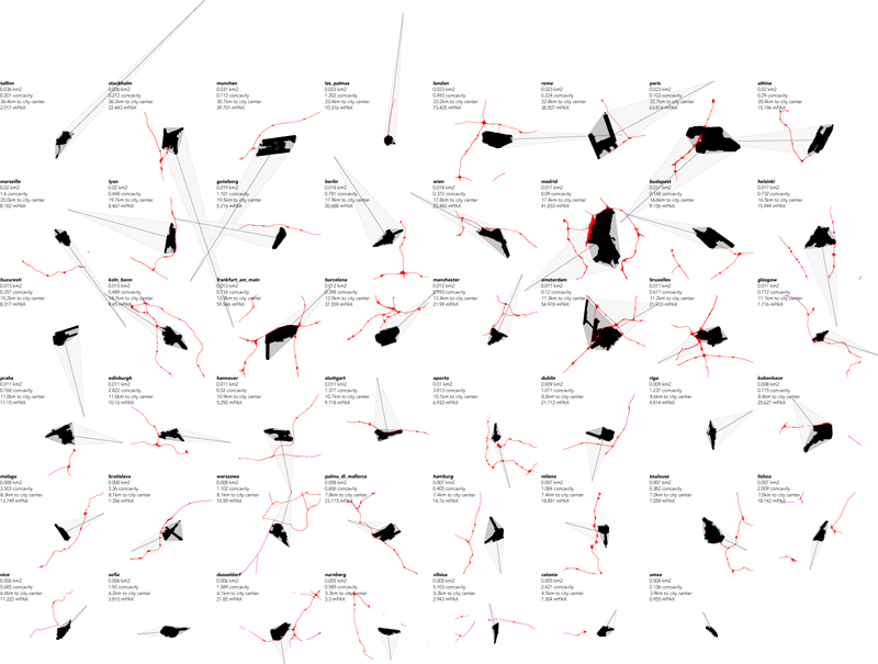
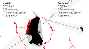
In the image below I have extracted 48 of the largest airports in Europe, along with the distance and direction to the city center, and adjacent highways. (Here the airports are sorted by distance to city center.) An additional script checks the ‘concavity’ of the airport (fence-line) and its orientation to surrounding urbanized areas.